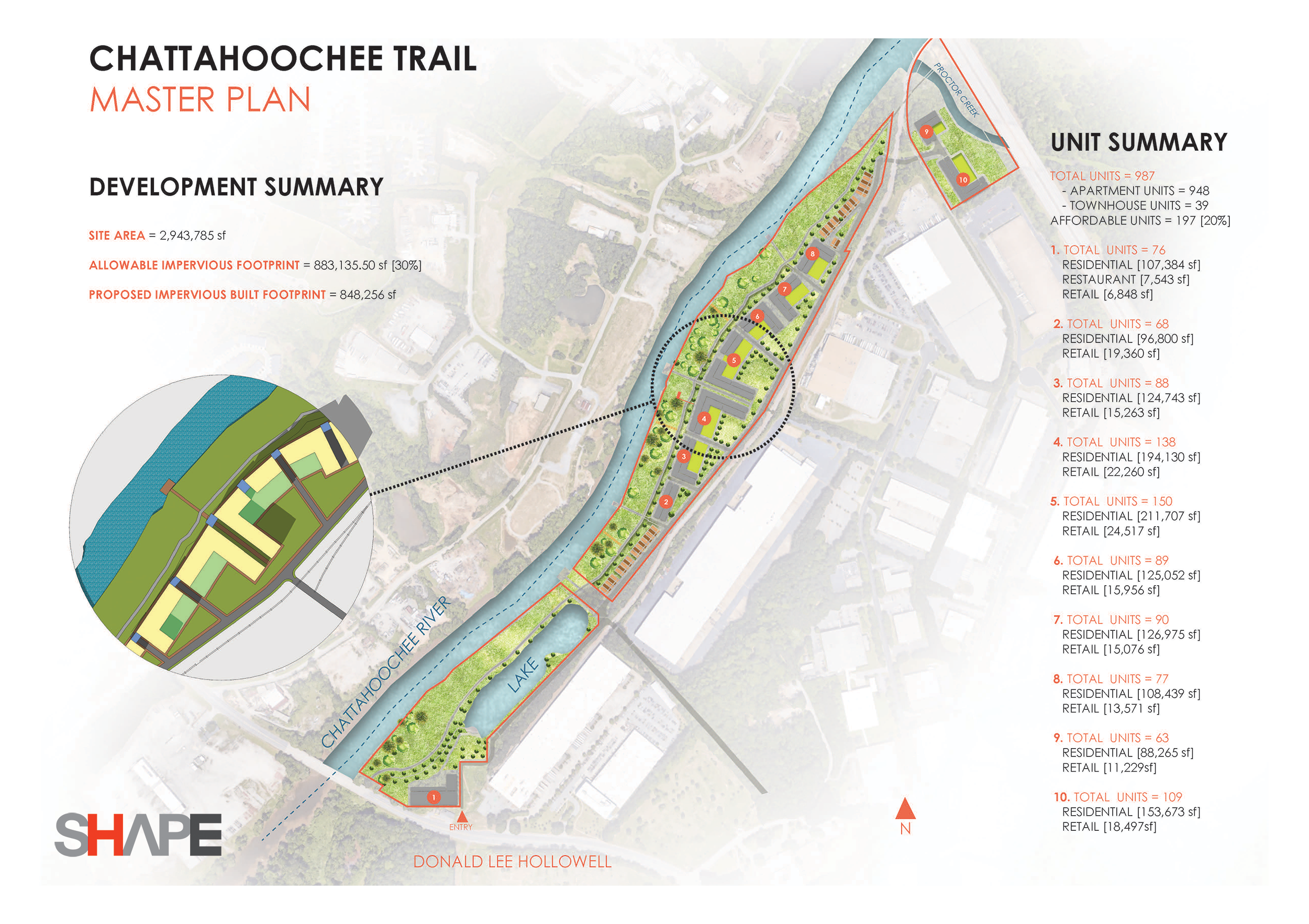
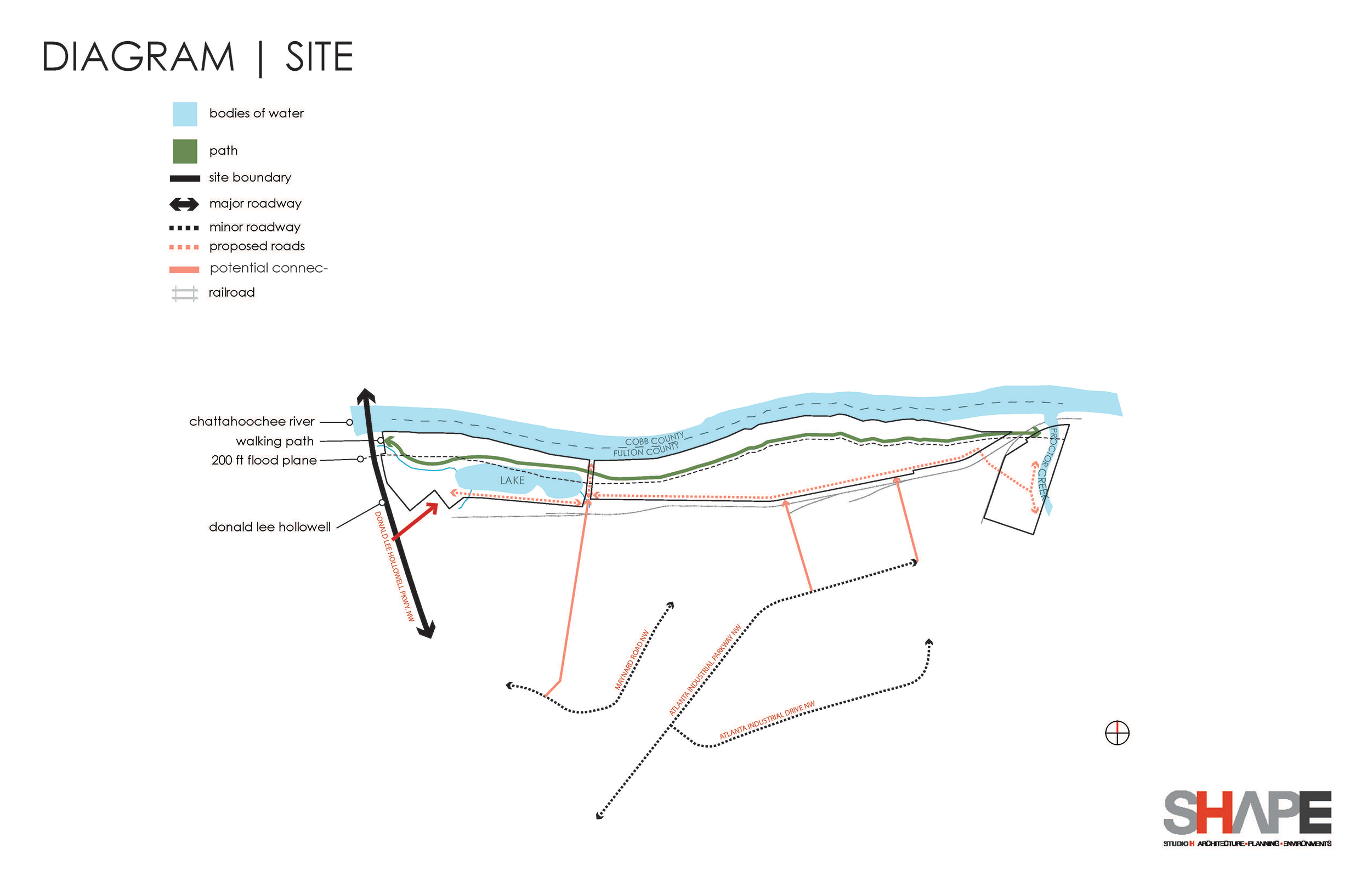
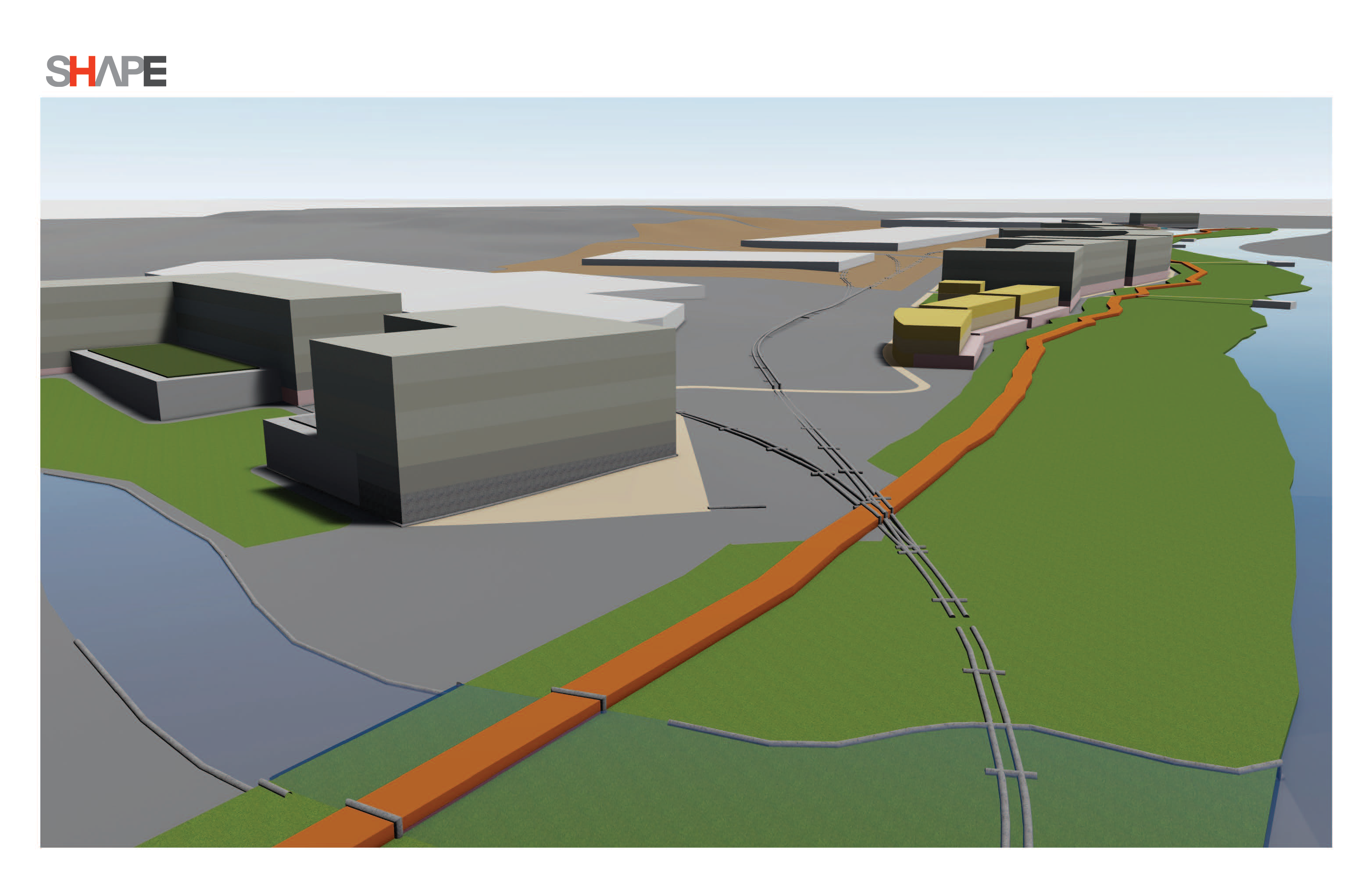
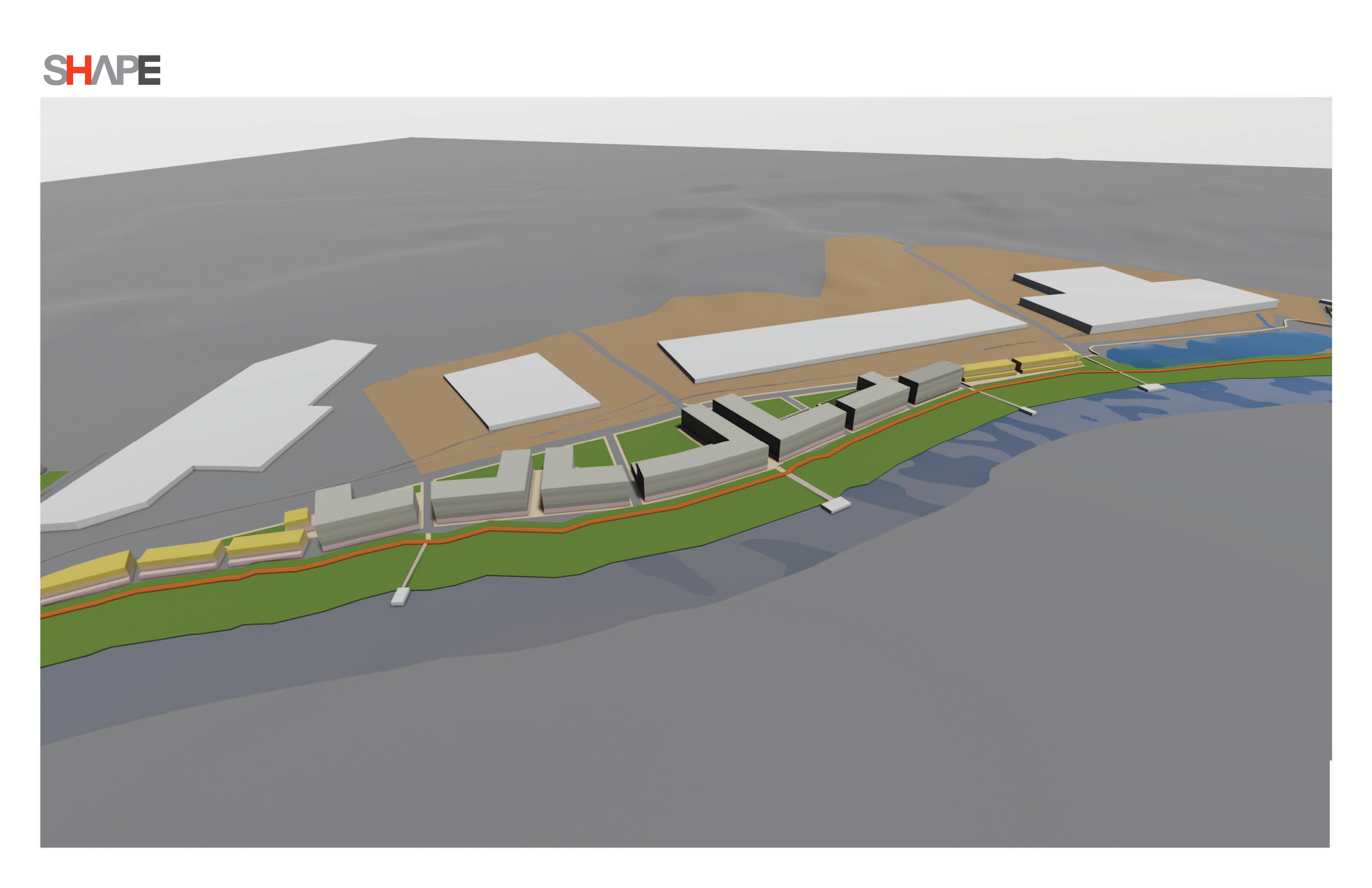
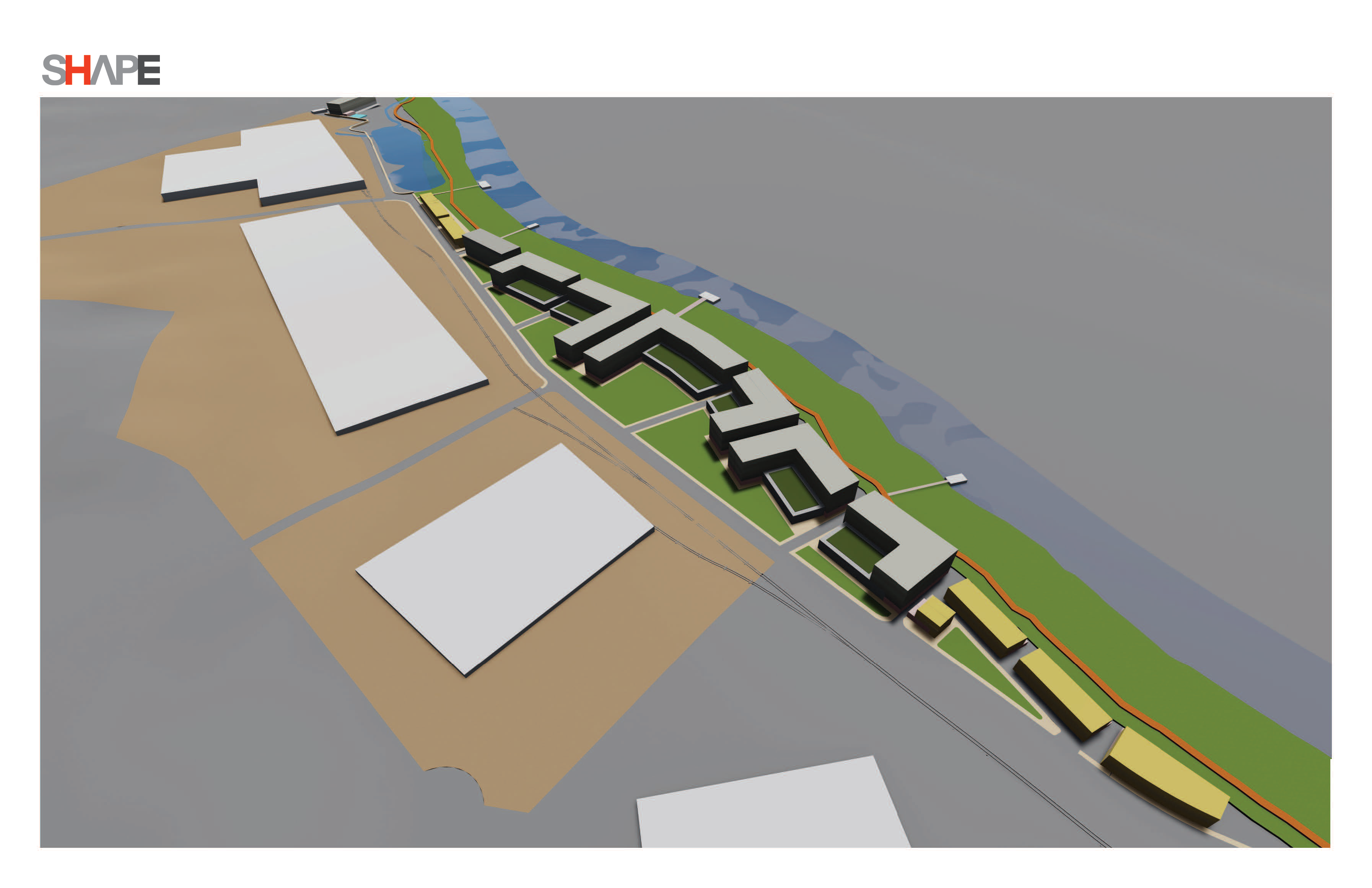
The purpose of this Master Plan Concept is to provide a high-level conceptual plan footprint that supports the owner’s intent to provide a
residential housing development along the river to achieve the maximum number of units. There is also an opportunity to provide at least one retail/restaurant to support the river life and activities.
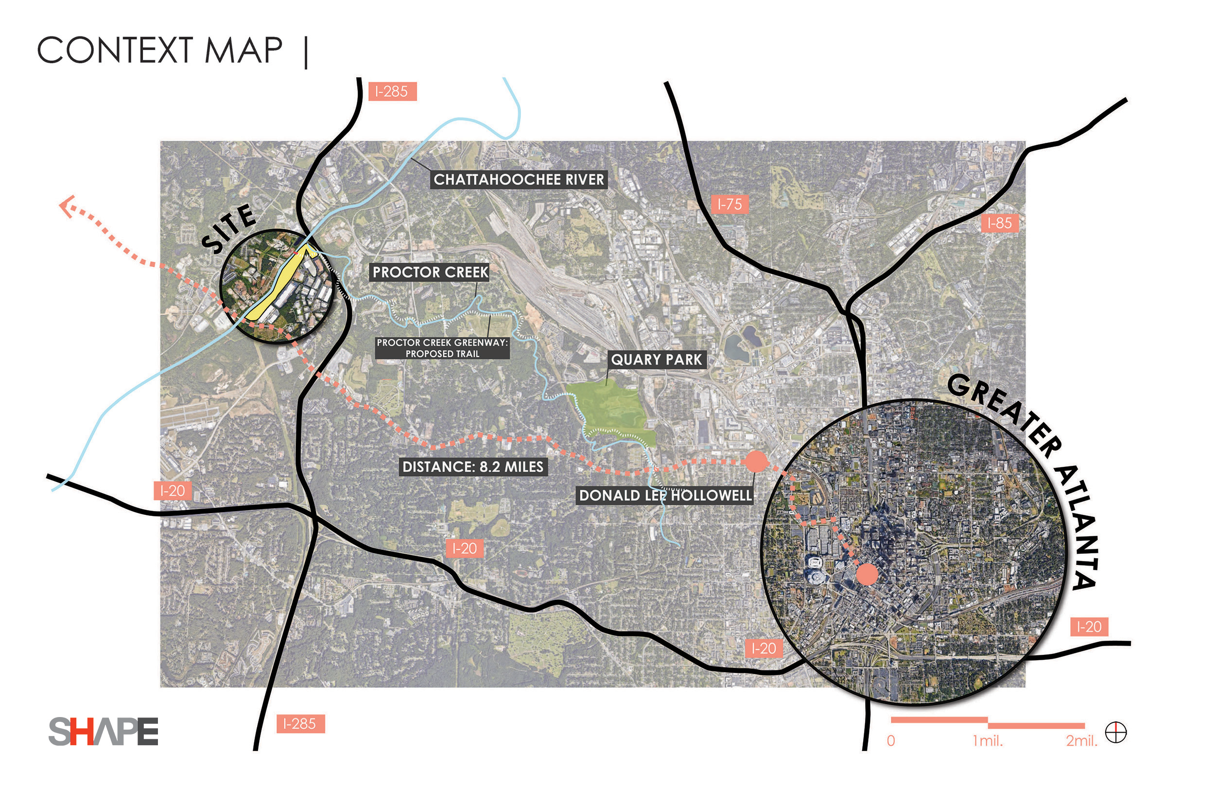
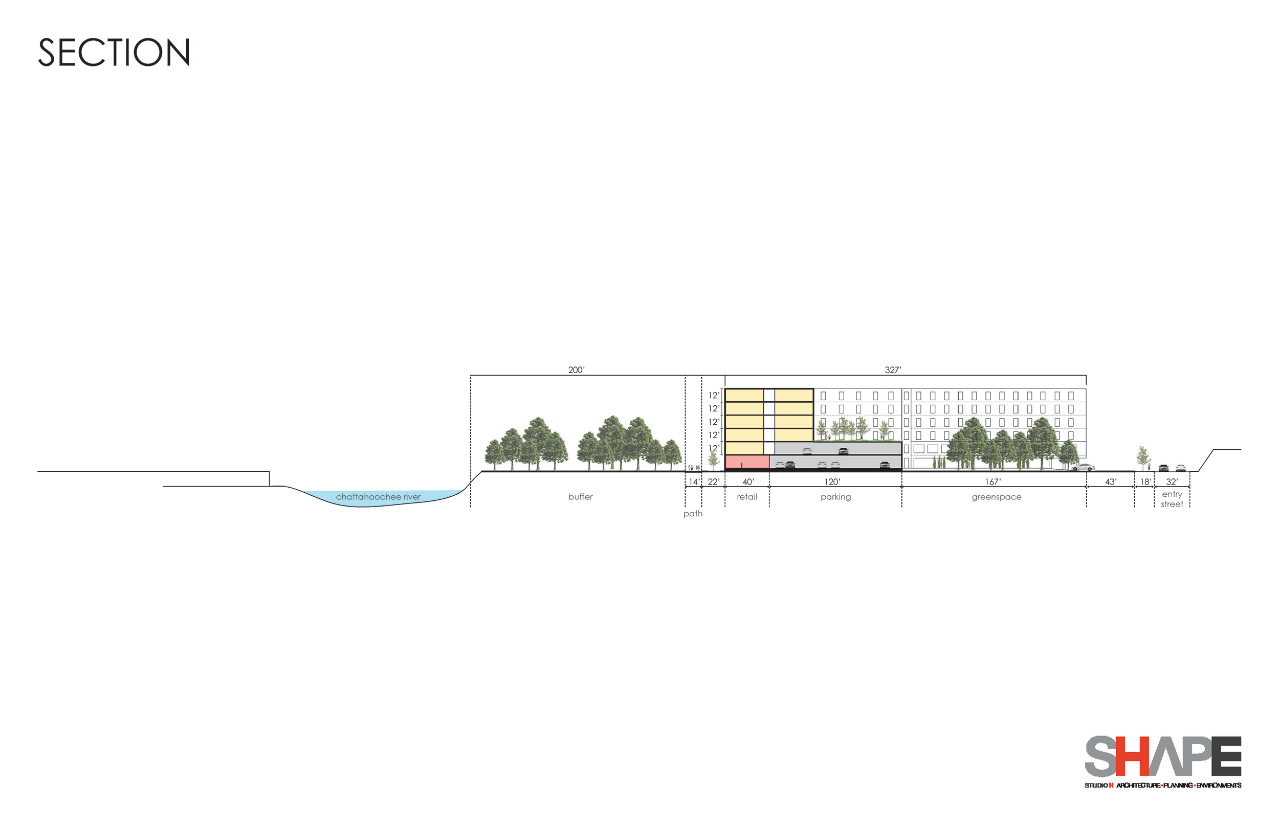
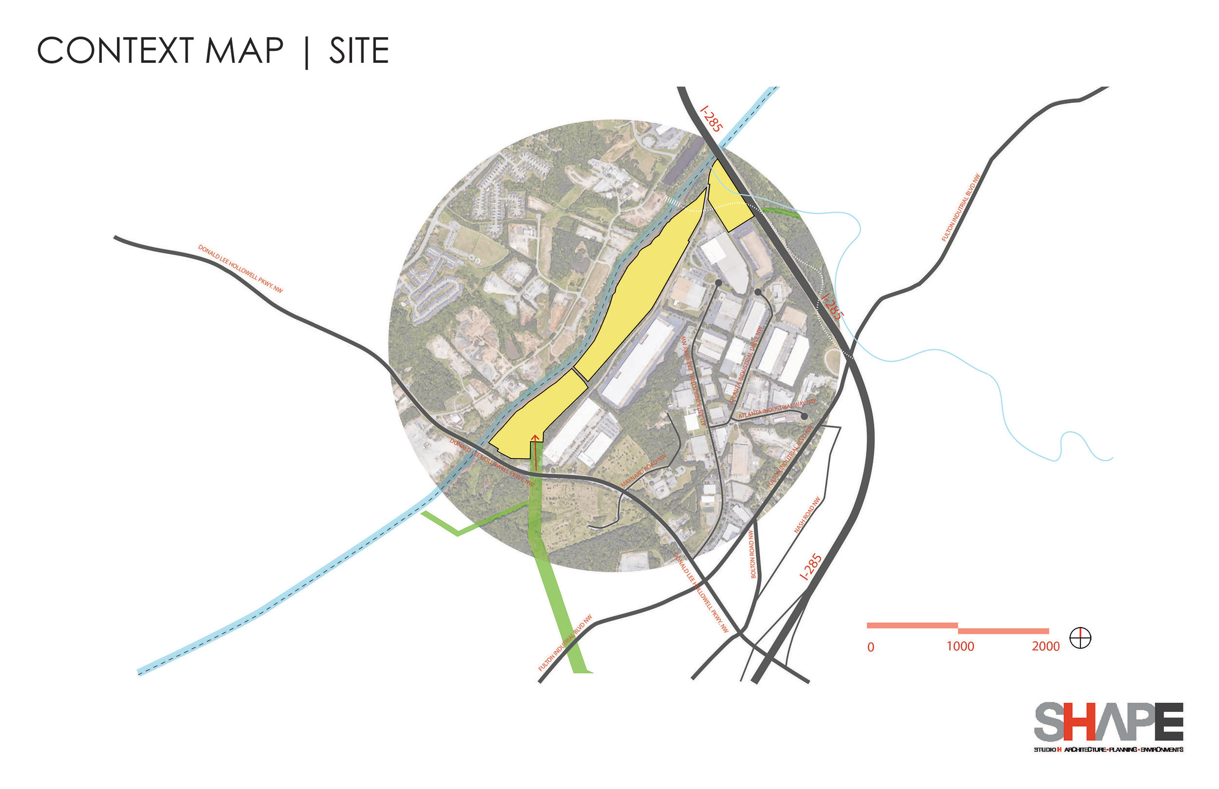
This initial plan has an objective of being presented to the City within 1-week to justify a land exchange where as the development will utilize the entire 64 acres as part of the land development calculations and in return the City will build a trail/path along the river within the 200-foot strip river frontage.
A FEMA Flood Map study has been completed and the majority of the property is located within the flood plain. The Atlanta Regional Commission Chattahoochee Corridor Study sets parameters that corresponds to Vulnerability Zones and this property predominated lies within Vulnerability Zone E with a maximum impervious surface rate of 15% and disturbed area of 30%. However, in order to incorporate an affordable housing component and to justify the land exchange the Master Plan shall use rates of impervious surface rate of 30% and disturbed area of 50%.